Met Office issues warning across UK as thunderstorms to smash Britain
UK weather: Met Office forecasts ten day trend
We use your sign-up to provide content in ways you’ve consented to and to improve our understanding of you. This may include adverts from us and 3rd parties based on our understanding. You can unsubscribe at any time. More info
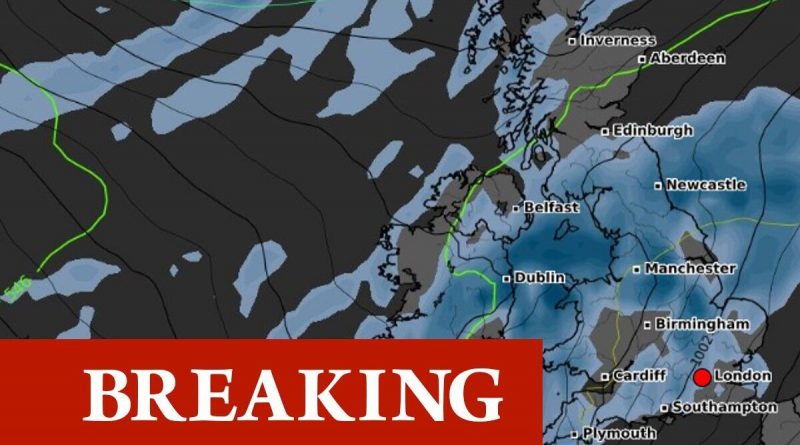
The Met Office has scrambled to issue a weather warning which is already in place and lasting until early this afternoon. It warns of potential thunderstorms and flash flooding with up to 30mm of rain falling in an hour. The yellow warning, in place until 1pm today, covers eight regions from Yorkshire, the east of England, parts of London and the south east, the north east and west, and both East and West Midlands. A Met Office statement says: “Bands of heavy showers and thunderstorms will move quickly northwards this morning.
“Not everywhere will see these, but where they do occur, 20 to 30mm of rain is possible within an hour, and perhaps as much as 40 mm in a few places. Lightning will be an additional hazard. Rain will continue this afternoon but become less intense.”
In terms of what to expect, the Met Office says there is a small chance of homes and businesses becoming flooded quickly, and that damage could be caused by lightning strikes, hail or strong winds.
Where flood water collects, particularly on roads, this may lead to delays and cancellations including bus and train services. People should be mindful of sudden dangerous driving conditions and be aware that roads may suddenly close.
And there is also a slight chance of power outages in areas most adversely affected.


In the Met Office’s tips for driving amid thunderstorms it advises people to be aware that lightning currents can travel through parts of modern cars, including GPS and radio systems.
This can even include interior handles. foot pedals and steering wheels. Thunderstorms can also bring a risk of sudden gusty winds, those most at risk would include cyclists, motorcyclists and high sided vehicles.
In terms of promoting road safety, drivers are told to give more room than usual to vulnerable road users – which includes cyclists and motorcyclists – as they are “more likely to be blown around by side winds”.
And, it also urges drivers to keep an eye on their speed in a bid to avoid any preventable accidents.
The Met Office issued the current weather warning this morning amid concerns for the weather impacts on certain areas of the country.
Its forecast for the rest of the week and into next week does also suggest thunderstorms and more unsettled conditions could continue, but there are currently no other warnings or alerts in place.
Its long range forecast looking towards next week and the rest of the month adds: “To begin the period, unsettled conditions are expected with rain or showers for many. The northeast is likely to experience the most persistent rain on Monday, with heavy, occasionally thundery showers, interspersed with drier, sunny spells elsewhere.
“Further wet weather is likely to move in from the southwest on Tuesday. Generally windy for most, with a risk of coastal gales in the southwest at times.
“Unsettled conditions are expected to continue dominating through the remainder of this period, with further showers and longer spells of rain for many. A risk of stronger winds or gales at times, particularly in the north and west. Temperatures will most likely be above normal for much of the UK.”
Source: Read Full Article


