Denver weather: February to start with frigid temperatures, snow
Denver will start the week in the high 50s, but a change to the weather is coming soon, and it will bring an arctic blast of air along with some snow.
According to the National Weather Service in Boulder, Denver will reach 57 degrees on Monday under mostly sunny skies. Winds will blast the area, possibly gusting over 30 mph at times downtown, while the region could experience breezes of 80 mph. There’s a High Wind Warning in effect for the foothills during the day. The weather will turn Monday night as temperatures dip to 20 degrees.

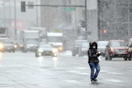
February will begin with some snow, as the high temperature will only reach 40 degrees Tuesday. A trough will push up against us, producing light snow. A half-inch of snow is expected to accumulate with a 40% chance of precipitation after 11 a.m. Winds could gust to 15 mph. A second front will move in later in the day, dropping the temperature much more.
Tuesday night into Wednesday morning is when most of the flakes will fall. There’s a 70% chance of precipitation, with 3 inches possible overnight. The low will be 14 degrees.
Wednesday will stay wintery, with a high of 18 degrees and snow continuing.
Forecasters say upslope winds into the foothills will lead to more significant snowfall over the hills and urban corridor Tuesday evening and overnight. The early prediction is that by Wednesday night 2 to 5 inches will have dropped across the plains, 6 to 12 inches in the foothills and east slopes of the Front Range mountains, 3 to 6 inches for the west slopes and 1 or 2 inches in the mountain valleys. Light to moderate snowfall is probable for most of the Denver metro area.
NWS warns that the urban corridor, mainly west of I-25, will see significant snowfall accumulations of 5 to 10 inches. They said winter weather advisories might become necessary for travel impacts.
Wednesday night temperatures are expected to be below zero. And again, Thursday night will have single-digit lows.
Source: Read Full Article