Met Office issues new snow warning for three regions as UK faces chaos
UK weather: Met Office forecasts cold and breezy conditions
We use your sign-up to provide content in ways you’ve consented to and to improve our understanding of you. This may include adverts from us and 3rd parties based on our understanding. You can unsubscribe at any time. More info
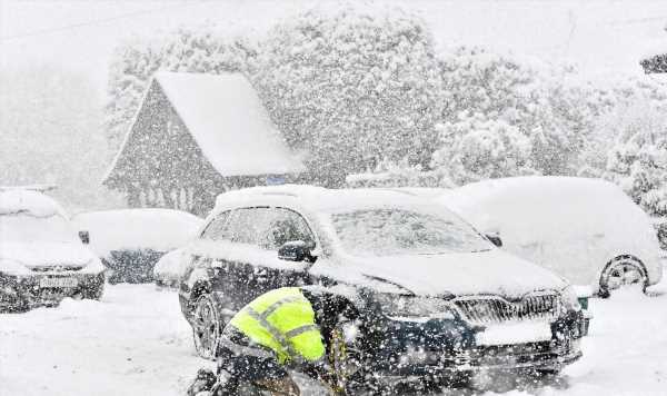
A fresh series of snow weather warnings have been issued for three UK regions. The next 72 hours are under scrutiny as many parts of Britain are set to see snowfall, icy conditions and disruption as a long-awaited cold Arctic blast finally hits. The new yellow warnings have been issued by the Met Office today.

The first snow and ice warning activates at 9pm – and covers the East Midlands, the east of England, London and the south east, south west England, parts of Wales and the West Midlands.
The Met Office says: “A band of rain will edge southwards through the course of Monday evening and early Tuesday, this rain turning to snow on hills and perhaps to lower levels in places.
“Many areas will see little or no accumulations of snow, but 1 to 2 cm could settle in some spots, most likely over high ground and southern parts of the warning area.
“The rain and snow is then expected to turn light and patchy as it slowly clears southern England on Tuesday. As skies clear overnight, ice is also likely to form readily on untreated surfaces.”


A separate snow and ice warning for Northern Ireland also comes into place ay 9pm – expiring at 10am tomorrow. All warnings indicate disruption on public transport and tricky driving conditions, especially overnight when temperatures drop.
Despite gritters being deployed, they only treat primary and main routes, which means some smaller, residential and rural roads may have slippery and icy patches.
From midnight tomorrow a new warning will come into play for much of Scotland and the north east coast of England, with the Met Office warning: “Frequent snow showers will continue, causing further disruption in places.”
It adds: “Cold, blustery northerly winds will continue to drive frequent showers of snow and hail into these areas on Tuesday. The highest accumulations are likely again over the high ground of northern Scotland, where another 5-10 cm are possible by the end of the day.

“Accumulations at lower levels are most likely Tuesday early hours where 2-5 cm could accumulate locally.
“During Tuesday night, showers will then tend to become increasingly confined to northern Scotland. Icy stretches are likely, especially on untreated surfaces, particularly during hours of darkness.”
We’ll be bringing you the very latest updates, pictures and video on this breaking news story.
For the latest news and breaking news visit: express.co.uk/news
Stay up to date with all the big headlines, pictures, analysis, opinion and video on the stories that matter to you.
Follow our social media accounts here on facebook.com/DailyExpress and @daily_express
Source: Read Full Article