Met Office warns ‘nine hour storm’ set to wipeout UK bringing days of chaos

Don’t miss a thing! Sign up to the Daily Star’s newsletter

We have more newsletters
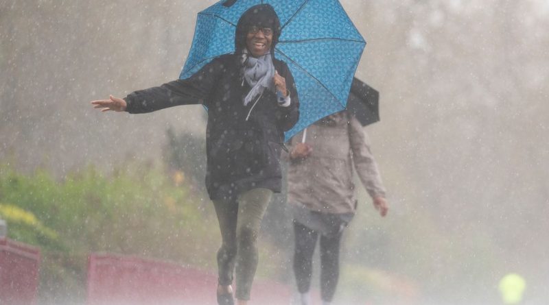
Hotter temperatures mixed with torrential downpours look set to bring storm chaos to some parts of the country over the coming days.
Weather forecasters at the Met Office have issued a yellow weather warning that came into force late on Sunday (May 7) and could continue into today (Monday).
Initially, parts of Northern Ireland could be hit by some damage to a "few buildings and structures caused by lightning strikes", and that flash flooding could hit.
READ MORE: 'More snow coming' but UK weather forecasters 'can't rule out 30C' in May heatwave
In its UK-wide forecast, the Met Office said there could be some early sunshine in the far east but elsewhere should expect cloud and outbreaks of rain on monday (March 7) with Northern Ireland and Scotland brightening, with some thundery showers.
Then, from Tuesday (May 9) to Thursday it says: "Sunshine and showers each day. The showers locally heavy with a risk of thunder. Temperatures generally close to average but with mostly light winds, feeling warm in any sunshine."
According WXCHARTS a band of heavy rain pushing over central England, taking in London, Essex, parts of Kent, Cambridgeshire and Hertfordshire on Tuesday by noon, with the South West also being struck by downpours.
While an early thunderstorm warning has been issued for Northern Ireland, forecasters at Netweather suggest stormy conditions could hit the entire eastern coast of England and Scotland.
It has issued a "thunderstorm watch" alert which is in place until early Monday, adding: "Once morning cloud breaks up, it will allow scattered heavy showers to develop across central and south eastern Scotland, eastern England, East Anglia and perhaps the far south east of England.
"Cloud tops may gain sufficient height for one or two short-lived thunderstorms to develop – especially over East Anglia, but the window for strong convection will be rather limited.
"Low thunderstorm risk will quickly fade early evening. A few funnel clouds can't be ruled with stronger updrafts."

To stay up to date with all the latest news, make sure you sign up to one of our newslettershere.
Forecaster Terry Scholey said: "Bank Holiday Monday sees various frontal systems crossing the country from the west, bringing rain. This'll be heavy at times in the west, where it'll be misty at times with some hill and coastal fog.
"But across East Anglia and the South East, where it'll be a bright start, the weather may just 'hold off' long enough to prevent a soggy street party.
"Towards evening, Northern Ireland may see signs of a change to brighter weather, although still with a scattering of showers.
"A moderate or fresh southerly wind may continue to give strong gusts in the North West and west for a while. But despite the cloud and rain, temperatures should still manage to reach 14C to 16C fairly generally and probably 17c to 19C for a time across East Anglia and the South East."
READ NOW:
- UK to see extreme fluctuations in weather temperature going from -7C to 19C in just days
- Met Office issues weather warning as ferocious gusts and extreme downpours set to hit
- Met Office verdict on exact weather during Coronation after 'thunderstorm' warning
- Met Office say Coronation day could be hottest of year so far but warn of thunderstorms
- King Charles III's heartwarming response to weather despite 'Coronation curse' theory
- Met Office
- Weather Forecast
- UK Weather
Source: Read Full Article