UK snow warning as strong gusts to ‘fire up North Sea showers’
Met Office warns of snow for some areas of UK
We use your sign-up to provide content in ways you’ve consented to and to improve our understanding of you. This may include adverts from us and 3rd parties based on our understanding. You can unsubscribe at any time. More info
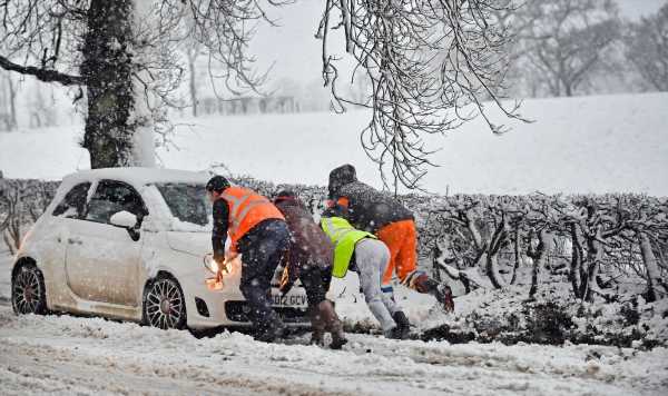
Britain could be smothered by heavy snow and bitterly cold weather in a matter of days as the unseasonal mild weather comes to a shuddering halt. The latest UK weather maps from WXCHARTS begin to turn icy white during the early hours of March 5, with snow threatening large parts of Scotland and northern England.

This snow risk quickly spreads southwards throughout the day along the English east coast, as far down as Manchester in the North West. There is continued snowfall on the morning of March 6, with the weather maps showing all of Scotland under threat from at least a dusting.
But this intensifies significantly two days later on March 8, with the UK map once again turning icy white as heavy snow begins to set in.
During the early period, up to 5cm of snow could fall in northern regions of Scotland, with 2cm falling in several other surrounding areas north of the border.
The threat of snow once again spreads southwards throughout the UK, with the North East and North West in England, as well as some regions of Wales, at risk.

Heading into the afternoon on that same day, snowfall is forecast to once again intensify, with 6-8cm falling in northern areas of Scotland.
The North East of England around Newcastle could also be hit by 3cm of snow, with more falling in several other surrounding areas, as well as in the North West and Wales.
This snowfall could also be accompanied by bitterly cold temperatures, with the UK weather maps turning icy blue on March 5 with lows of -3C in Scotland and Wales, with the mercury falling to below freezing throughout the rest of Britain.
The bitterly cold temperatures continue 24 hours later, with similar lows showing across the UK as the weather map once again turns icy blue.

AccuWeather senior meteorologist and lead European forecaster Tyler Roys told Express.co.uk during the first full week of March, “a late season cold shot” could hit the the UK, with temperatures expected to be below normal.
Under one modelling set up, an “east or northeasterly wind could fire up North Sea Effect snow showers” many eastern parts of the country.
The sudden stratospheric warming event that took place last week will trigger this weather pattern, with another such event “likely to occur in early March”, allowing cold air to surge in from the northeast, he said.
Mr Roys added: “Next week high pressure is largely going to be in control of the weather across the UK with temperatures near to below normal.
DON’T MISS
Rishi Sunak ‘needs to worry’ about raising tax rate to 25% [COMMENTS]
Woman ‘shunned by her family’ after claiming to be Madeleine McCann [REPORT]
Man who spotted Nicola Bulley’s body reeds breaks his silence [LATEST]


“The area of high pressure next week is likely going to shift to the west of the UK for the first full week of March. If this does occur, a late season cold shot is expected to encompass northern, central, and western areas, including the UK. Temperatures are expected then to be below normal.
“At this time, it is too early to say how cold it could get. The modelling is just jumping on board to this occurring. Under this set up, an east or northeasterly wind could fire up North Sea Effect snow showers for various parts of the eastern UK.
He added: “A Sudden Stratospheric Warming event that took place last week is kick starting the upcoming weather pattern with another event likely to take place in early March, this is likely to displace the Polar Vortex towards northwestern Russia and Scandinavia, allowing the cold air to surge in from the northeast.”
BBC Weather has also commented on the sudden stratospheric warming event that is occluding above the Arctic, warning of the possibility of “wintry showers” hitting the UK.

For the period March 6-19, the forecaster has said: “There is still some uncertainty from the second week of March through to the middle of the month.
“This is largely because of current goings-on in the stratosphere, where the polar vortex is being disrupted and pushed away from the pole as a major sudden stratospheric warming event unfolds high above the Arctic.
“If the troposphere hooks up to this disturbance, then we could see impacts across Europe after about three weeks.
“This does not always happen, hence the doubt, but there is more of a chance with this event than any of the weaker polar vortex disturbances previously this winter, given the strength of the stratospheric warming and full reversal of wind direction around the pole.
BBC Weather continued: “The upshot could be high pressure relocating north and northwestwards, while low pressure develops across southern and western Europe, inducing wind flows from colder directions.
“Although confidence is rather low it has grown somewhat in the past week, with models starting to reflect the possibility.
“If this colder set-up evolves as expected, then we could see wintry showers coming from the east, with low pressure edging up from the south.
“Southern areas of the UK could become more susceptible to increasing precipitation than the north. However, it’s too early to speculate on its exact nature yet.”
Source: Read Full Article