Colorado weather: Record cold hits Denver during severe winter weather
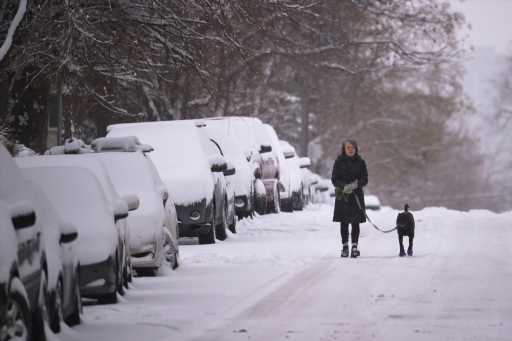
As hazardous snow totals fall in the northern mountains and dangerously cold temperatures continue across most of eastern Colorado, Denver saw record low temperatures overnight Sunday.
Multiple warnings and advisories have been issued in the state, and the winter weather will continue through Tuesday morning before temperatures in the east rise and the mountain snow stops.

The cold temperatures hit Denver and eastern Colorado Sunday, plummeting temperatures to single-digit highs and a record-tying overnight low. Denver bottomed out at -10 degrees, tying the record set in 1985.
Temperatures Monday won’t improve, as Denver’s high is nine degrees again.
A wind chill advisory has also been issued from the Interstate 25 corridor all the way over to the Kansas and Nebraska borders for Monday morning until 9 a.m., then again from 9 p.m. Monday night to 8 a.m. Tuesday. Wind chills could reach as low as -20 degrees overnight during the second advisory.
“The dangerously cold wind chills could cause frostbite on exposed skin in as little as 30 minutes,” the advisory states.
Additional to the frigid temperatures snow falling in the mountains Monday morning will drop up to seven inches in the winter-storm-warned northern Front Range and Park Range mountains.
Those areas already saw heavy snowfall over the weekend, with Rabbit Ears Pass and Mount Zirkel in the Park Range getting the most snow with 22.5 inches and 37.5 inches, respectively.
Monday’s snow band will move further south into the Interstate 70 mountain corridor and the Denver metro area Monday afternoon, possibly impacting the evening commute since an inch or two of snow could fall in Denver then.
After the severe overnight wind chills, and a -2-degree low, Denver will warm up Tuesday afternoon with a high of 35 degrees. Temperatures might be lower, though, as fresh snowfall could dampen the temperature increase.
Source: Read Full Article